“What is the best software for geologists?” is one of the most searched questions by those starting their career, changing practice or renewing licences. The honest answer is: it depends on what you do. A geologist writing geological and geotechnical reports for building projects uses different tools from someone working in hydrogeology, seismic microzonation or mapping. This guide, updated in September 2026, lists the most widely used software in Italy and Europe category by category — commercial, free and open source — with one simple criterion: what is really needed in professional practice under Eurocode 7 and the Italian NTC 2018 code.
Transparency note: this guide is published by GeoStru, which develops some of the software mentioned. We have also included alternatives from other vendors and the free tools geologists use every day, because a guide that only lists its own products is of no use to anyone.
At a glance: software for geologists, category by category
| Field | Most widely used software | Free / open source |
|---|---|---|
| GIS and mapping | QGIS, ArcGIS Pro, Maps NX, Atlante NX | QGIS, Google Earth Pro, Atlante NX, Georisk |
| Borehole logs, sections, 3D models | Stratigrapher, Slope 2D Section, GM3D, Leapfrog, RockWorks, Strater | Lithological patterns, Auto Cross Section |
| Geotechnical design (EC7 / NTC 2018) | Loadcap, MP, CVSOIL, Liquiter, GFAS, GEO5, Plaxis | Geostru Formula, GeoApp |
| Slope stability and landslides | Slope, GSA, MRE, RockPlane, GeoRock, Slide2, GEO5 | SSAP |
| In-situ testing | Dynamic Probing, Static Probing, Downhole, CPeT-IT | GeoApp (correlations) |
| Hydrogeology and hydraulics | GeoTheis, Runoff Lab, Hydrologic Risk, HID NX, FEFLOW | MODFLOW, HEC-RAS, HEC-HMS |
| Geophysics and seismics | Easy HVSR, Easy MASW, RSL III, PS Advanced, winMASW, Grilla | Geopsy, DEEPSOIL, STRATA, REXEL |
1. GIS and mapping: the foundation of every geological report
Every report starts with a territorial overview: geological map, hydrogeological hazard plans, constraints, DEM, contour lines, regional WMS services. Here the market is clear.
- QGIS — open source and free, it is the de facto standard in geology practices. It reads every format, connects to regional and national WMS/WFS services, and produces hazard maps and location plates. The learning curve pays for itself within a few weeks.
- ArcGIS Pro (Esri) — the commercial reference in public bodies and large engineering firms. Excellent for remote sensing and advanced spatial analysis, but with a licence cost that weighs on a single practice.
- Google Earth Pro — free, indispensable for preliminary reconnaissance and for exchanging KML files with clients and contractors.
- GeoStru Maps NX — a web map for survey and design: points, tracks and areas, elevations sampled from the digital terrain model, section profiles and node grids, export to DXF, CSV and UTM coordinates. Built for those who need to go from site visit to cross-section without opening three programs.
- GeoStru Atlante NX — builds the documentary basis of the report (geological, geotechnical, seismic, hydraulic) from a single point, querying public territorial sources and returning referenced evidence and ready-made plates. It is free: all you need is a GeoStru NX account, also free.
- Georisk — free app to check the seismic hazard and risk of the place where you are standing.
2. Borehole logs, geological sections and 3D modelling
Borehole logs and cross-sections are the most visible product of a geologist’s work, and the one where most time is lost when the tool is wrong.
- Stratigrapher — stratigraphic columns and borehole logs: lithologies with standard patterns, samples, in-hole tests, water table, instrumentation, export to DXF and image. It is among the most widespread GeoStru programs in Italian practices; a Stratigrapher LT version also exists.
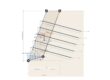
- Slope 2D Section — 2D geological and geotechnical sections from the topographic profile and boreholes, with the stratigraphy ready for stability checks. The web version is GeoSection NX.
- GM3D — three-dimensional geological-geotechnical model reconstructed from boreholes and tests, with sections in any direction and volumes.
- Lithological patterns — free library of hatch patterns for CAD, for those who draw sections by hand.
- Leapfrog Geo (Seequent) — implicit 3D geological modelling; extremely powerful, but sized for mining and large infrastructure.
- RockWorks and LogPlot (RockWare) — long-established American programs for borehole logs and stratigraphic data management in 2D and 3D.
- Strater and Surfer (Golden Software) — logs and gridding/contouring, widely used in hydrogeology and environmental work.
3. Geotechnical design and the geotechnical report (EC7 / NTC 2018)
This is where the choice of software matters most: the geotechnical report must follow the design approaches and partial factors of Eurocode 7 and of the Italian NTC 2018 (§6.2), and the program must produce a defensible calculation report.
- Loadcap — bearing capacity and settlement of shallow foundations with the classical methods (Terzaghi, Meyerhof, Hansen, Vesic, Brinch-Hansen, EC7), NTC 2018 design approaches 1 and 2, liquefaction check and complete geotechnical report. It is the program many Italian geologists learned geotechnical verification with. The web version with AI is Loadcap NX.
- CVSOIL — statistical determination of the characteristic geotechnical parameters required by the codes (NTC 2018 §6.2.2).
- MP — piles and micropiles: vertical capacity with five classical methods, NTC 2018/EC7 design resistances, Broms lateral load, settlements, non-linear FEM on elastic soil. Web version: MP NX.
- Liquiter — liquefaction potential with the simplified methods (NTC 2018 §7.11.3.4) from SPT, CPT and Vs. Web version: LiquiTer NX.
- Retaining structures and special foundations — MDC (retaining walls), SPW (sheet piles and diaphragm walls), Well Foundation (caisson foundations), DeepFound (piled rafts), Fondazioni CA (RC beams, grillages, rafts and footings on piles or Winkler soil; how it applies NTC 2018).
- GFAS — non-linear FEM for tunnels, staged excavations, slopes, settlements, soil-structure interaction, seepage and modal dynamic analysis, developed by the GeoStru team for over twenty years with the collaboration of the Technical University of Cluj-Napoca: for the cases where limit equilibrium is not enough.
- GEO5 (Fine, Czech Republic; distributed in Italy by Eiseko) — a modular suite widely used across Europe, with EC7 and national annexes. It is often compared with GeoStru: the two suites cover similar fields with different philosophies: we have written a detailed GeoStru vs GEO5 comparison.
- Plaxis 2D/3D (Bentley), RS2 and Settle3 (Rocscience), Midas GTS NX — high-end geotechnical FEM for tunnels, large excavations and soil-structure interaction.
4. Slope stability, landslides and rock slopes
Slope stability verification is probably the calculation most often requested from a geologist: building permits on hillsides, hydrogeological hazard plans, development plans, landslides.
- Slope — limit equilibrium analysis with the methods of Fellenius, Bishop, Janbu, Spencer, Morgenstern-Price, Sarma and with the discrete element method (DEM); soils and rock masses, water table and pore pressures, seismic action with pseudo-static analysis, back-analysis, stabilisation works (piles, anchors, geogrids, soil nailing, gabions, reinforced earth). It is among the most widespread slope stability programs in Italian practices.
- GSA — global stability of retaining structures (walls, sheet piles) within the slope.
- MRE and SNL — reinforced earth and soil nailing; MRE is also available as MRE NX.
- Rock slopes — RockPlane (planar stability and consolidation of rock blocks, also RockPlane NX), GeoRock 2D and GeoRock 3D (rockfall and rockfall barriers), GMS (geomechanical survey and stereographic projections, also GMS NX), RockLab (Hoek-Brown).
- SSAP — free, developed by Lorenzo Borselli, widely used in Italy in academia and practice for limit equilibrium with automatic search of critical surfaces. Excellent for checking results with a second calculation engine.
- Slide2 and RocFall (Rocscience), GEO5 Slope Stability, Plaxis — international commercial alternatives.
5. In-situ testing: dynamic probing, CPT, downhole
- Dynamic Probing — processing of DPL/DPM/DPH/DPSH dynamic penetration tests and in-hole SPT: NSPT, geotechnical correlations, NTC subsoil category, bearing capacity. Web version: Dynamic Probing NX.
- Static Probing — CPT, CPTU and CPTE tests with Robertson classification and correlations for strength and deformability parameters.
- Downhole — interpretation of down-hole tests for the Vs profile.
- GIT — estimate of the significant geotechnical volume for the investigation programme.
- CPeT-IT (Geologismiki) — international reference for CPTU interpretation according to Robertson.
6. Hydrogeology, hydrology and hydraulics
Here the world standards are free and produced by US public agencies, alongside Italian tools for routine processing.
- MODFLOW (USGS) — the standard for numerical simulation of groundwater flow, free, with the ModelMuse interface; commercial front-ends (Visual MODFLOW, GMS) make the work easier. FEFLOW (DHI) is the commercial finite element alternative.
- HEC-RAS and HEC-HMS (US Army Corps of Engineers) — free, the reference for hydraulic modelling of rivers and channels (1D/2D) and for rainfall-runoff transformation.
- GeoTheis — processing of pumping and recovery tests in wells for the hydrogeological parameters of the aquifer.
- Runoff Lab — hydrological processing: probability distributions of rainfall, intensity-duration-frequency curves, SCS-CN hydrographs. Web version with AI data import.
- Hydrologic Risk — flood discharges and hydrological risk of catchments.
- HID NX — hydraulic invariance: sizing of stormwater attenuation systems with five methods and regional regulatory profiles.
- ESD — verification of earth embankments and small dams.
7. Geophysics, seismics and local seismic response
Under NTC 2018 and Eurocode 8, the seismic characterisation of the site is an integral part of the geological report: Vseq, subsoil category, local seismic response, microzonation.
- Easy HVSR — processing of ambient noise (H/V spectral ratio), fundamental frequency, inversion for the Vs profile. Together with Easy MASW and Easy Refract it covers the most common active and passive field seismics. On joint MASW + HVSR analysis we published an article on the non-uniqueness of the Vs profile.
- RSL III — 1D local seismic response with equivalent linear analysis, surface response spectra and comparison with the code spectrum; RSL III 2D for two-dimensional geometries (valleys, basin edges).
- PS Advanced — basic and site seismic hazard, NTC 2018 design spectra for all limit states. Web version: PS Advanced NX.
- Seismic microzonation level 2 and 3 and RSL-III-A (free, for Italian Ordinance no. 55).
- Geopsy — open source, the reference for HVSR and array techniques (SPAC, f-k) and for inversion with Dinver.
- DEEPSOIL (University of Illinois) and STRATA — free, widely used for 1D local seismic response; useful as a second verification engine.
- REXEL — free, for selecting the spectrum-compatible natural accelerograms required by seismic response analyses.
- winMASW (Eliosoft) and Grilla (Moho, for the Tromino) — commercial alternatives very popular among Italian geophysicists.
8. Free software for geologists
Those who are starting out, or who want a second tool for cross-checking, can build an almost complete workstation at zero cost:
- Third-party open source and freeware: QGIS, Google Earth Pro, SSAP, Geopsy, DEEPSOIL, STRATA, REXEL, MODFLOW/ModelMuse, HEC-RAS, HEC-HMS.
- Free GeoStru tools: Atlante NX (the documentary basis of the report from public sources, with plates and Word: free with an NX account), GeoApp (over 70 free web applications for geotechnics, geology, hydraulics and seismics: correlations, quick checks, classifications), Geostru Formula (geology and geotechnics formulary), Lithological patterns, Auto Cross Section (topographic profiles in AutoCAD), Georisk and Geopix for Android. The full list is on the free resources for geotechnics and geology page.
The limit of free software, in professional practice, is almost always the same: the calculation report with the code references, support when something does not add up, and updates when the standard changes. Those are the three things you pay a licence for.
Two other well-curated lists of free tools that we recommend: Geocorsi’s guide to free and open source geoscience software and the free software for geologists page by Studio Geologico Bellucci (both in Italian).
9. Desktop or web? The choice in 2026
Until a few years ago the question did not exist: software for geologists was desktop, Windows, licensed. Today there are two models, and it is worth knowing both.
- Desktop with licence — the classic model of GeoStru, GEO5, Rocscience, Plaxis: you buy the program (or the suite, such as GeoBuild) and install it on your PC. Best for those who use the same tool every day.
- Web with AI and pay-per-use — GeoStru NX brings the programs into the browser, with no installation, an integrated AI assistant (import of PDFs and tables, explanation of results) and credit top-ups: you only pay when you calculate. The account is free, includes Atlante NX and gives 30 complimentary credits to spend on the calculation apps, which have no trial version. Best for those who run a calculation every now and then, work from several workstations or want to use a tool without buying the desktop licence. Today the NX modules cover foundations (Loadcap NX, MP NX), penetration tests (Dynamic Probing NX), liquefaction, rock slopes (RockPlane NX), geomechanical survey (GMS NX), reinforced earth (MRE NX), seismic hazard (PS Advanced NX), sections (GeoSection NX), mapping (Maps NX, Atlante NX), hydraulics (HID NX, Hydrogeo NX), bills of quantities and site accounting (Computo NX) and fee calculation (Compensi Pro NX).
How to choose the right software: five criteria
- Standards — the program must apply Eurocode 7 and the national code (NTC 2018 and Circular 7/2019 in Italy) without workarounds, with explicit partial factors and design approaches.
- Calculation report — it must come out complete, in your language, with assumptions, input data, methods and bibliographic references: that is what goes on file.
- Interoperability — import and export of DXF, KML/GIS, Excel; today also import of PDFs and data with AI. Closed software costs time every day.
- Support and updates — who answers when the verification does not add up? How often does a code update come out? An online manual (for GeoStru: help.geostru.io) is a good indicator.
- Cost and licence model — perpetual licence, subscription or pay-per-use: calculate the cost per job, not the list price. And always ask for a free trial before buying.
Frequently asked questions
It depends on the field. For GIS and mapping QGIS (open source) and ArcGIS Pro; for borehole logs and sections Stratigrapher and Slope 2D Section; for geotechnical design under EC7/NTC 2018 Loadcap, MP and GEO5; for slope stability Slope (GeoStru), SSAP (free) and Slide2; for hydrogeology MODFLOW and HEC-RAS (free); for seismics Easy HVSR, RSL III, Geopsy and DEEPSOIL. With over 50 programs GeoStru covers every category except pure GIS.
For professional practice under Eurocode 7 and NTC 2018 the most widely used are Loadcap (shallow foundations and geotechnical report), MP (piles and micropiles) and Slope (slope stability) by GeoStru, and the GEO5 suite by Fine. For finite element analysis of large works you move to Plaxis, RS2 or Midas GTS NX. The decisive criterion is the calculation report: it must state design approaches, partial factors and code references explicitly.
GeoStru is an Italian software house, active since the early 2000s, that develops over 50 desktop programs for geology, geotechnics, rock mechanics, in-situ testing, geophysics and seismics, hydrology and hydraulics, structures and energy (among the best known Slope, Loadcap, Stratigrapher, MP, Easy HVSR, RSL III, Dynamic Probing, GeoRock), the GeoBuild suite, the GeoStru NX web platform with artificial intelligence and pay-per-use (free account with Atlante NX and 30 complimentary credits), and over 70 free web applications (GeoApp). Over 50,000 active licences in 135 countries.
Yes, and of excellent quality: QGIS for GIS, SSAP for slope stability, Geopsy for HVSR and seismic arrays, DEEPSOIL and STRATA for local seismic response, REXEL for accelerograms, MODFLOW, HEC-RAS and HEC-HMS for hydrogeology and hydraulics. GeoStru offers free of charge Atlante NX (with a free NX account and 30 complimentary credits), GeoApp (over 70 web apps), Geostru Formula, the lithological patterns, Auto Cross Section and the Android apps Georisk and Geopix.
They are two commercial suites covering similar fields. GeoStru is Italian, natively applies NTC 2018 and Circular 7/2019 alongside Eurocode 7 with a calculation report in several languages, has over 50 programs that can be bought individually or as a suite (GeoBuild) and offers the GeoStru NX web version with AI and pay-per-use. GEO5 is developed by Fine (Czech Republic), distributed in Italy by Eiseko, and is organised in modules with EC7 and national annexes. The choice depends on the practice’s workflow: it is worth trying both on the same real case.
Further reading
- Full catalogue of GeoStru software for geology and for geotechnics.
- GeoStru NX: the programs in the browser, with AI and pay-per-use.
- Free resources for geotechnics and geology.
- Request a free trial of the desktop software.
Guide updated in September 2026. Comments and additions: info@geostru.eu.